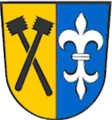
Category:Metten
market municipality of Germany | |||||
| Upload media | |||||
| Instance of |
| ||||
|---|---|---|---|---|---|
| Part of |
| ||||
| Location | Deggendorf, Lower Bavaria, Bavaria, Germany | ||||
| Located in or next to body of water | |||||
| Population |
| ||||
| Area |
| ||||
| Elevation above sea level |
| ||||
| Different from | |||||
| official website | |||||
 | |||||
Subcategories
This category has the following 4 subcategories, out of 4 total.
Media in category "Metten"
The following 20 files are in this category, out of 20 total.
-
DEU Metten COA.svg 512 × 559; 11 KB
-
MettenWappen.png 140 × 150; 4 KB
-
AK - Metten - 1918.jpg 800 × 1,060; 767 KB
-
AK - Photo - Metten - 1918.jpg 800 × 1,055; 699 KB
-
AK - Photo - Metten - 1920.jpg 1,500 × 2,000; 2.13 MB
-
Arbeiter Gedenkstein (Metten).jpg 2,992 × 4,000; 7.76 MB
-
Blick über Metten vom Heigelberg.jpg 2,592 × 1,944; 1.03 MB
-
Bücherschrank (Metten).jpg 2,992 × 4,000; 4.52 MB
-
Kloster Metten Panorama.jpg 20,000 × 10,000; 44.35 MB
-
Königreich Bayern - Denkwürdigkeiten und Schönheiten 467.jpg 3,408 × 2,544; 726 KB
-
Metten in DEG.svg 510 × 530; 363 KB
-
METTEN nieder.png 480 × 360; 5 KB
-
METTEN nieder.svg 512 × 427; 21 KB
-
Mittelalterliche Friedhofsanlage.jpg 3,672 × 4,896; 4.34 MB
-
Mittelalterlicher Friedhof.jpg 3,672 × 4,896; 4.53 MB
-
Nepomukkapelle, Metten.jpg 3,672 × 4,896; 3.25 MB
-
Panorama Metten.jpg 3,809 × 876; 2.61 MB
-
Perlbach Schild (Metten).jpg 4,000 × 2,992; 4.11 MB
-
Perlbach Schild 2 (Metten).jpg 4,000 × 2,992; 5.98 MB
-
Umfassungsmauer, Klosterkirche Metten.jpg 4,896 × 3,672; 4.04 MB


