File:Vojvodina03.png

Size of this preview: 519 × 600 pixels. Other resolutions: 208 × 240 pixels | 638 × 737 pixels.
Original file (638 × 737 pixels, file size: 66 KB, MIME type: image/png)
File information
Structured data
Captions
Captions
Add a one-line explanation of what this file represents
Summary
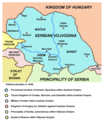
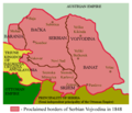
edit- English: Historical map of Serbian Vojvodina from 1848.
- Serbian: Историјска мапа Српске Војводине из 1848. године. / Istorijska mapa Srpske Vojvodine iz 1848 godine.
References
edit- Školski istorijski atlas, Zavod za izdavanje udžbenika Socijalističke Republike Srbije, Beograd, 1970.
- Dragomir Jankov, Vojvodina - propadanje jednog regiona, Novi Sad, 2004.
- Sima M. Ćirković, Srbi među evropskim narodima, Beograd, 2004.
- Dr Tomislav Bogavac, Nestajanje Srba, Niš, 1994.
- Milutin Perović - Milo Strugar, Istorija za 7. razred osnovne škole, Beograd - Novi Sad, 1993.
- Milutin Perović - Relja Novaković, Istorija za III razred gimnazije (opšti tip i društveno-jezički smer) i stručnih škola, Beograd, 1997.
Source and licence
editself made map by user:PANONIAN
from [en:Image:Vojvodina03.png]
| Public domainPublic domainfalsefalse |
| This work has been released into the public domain by its author, PANONIAN. This applies worldwide. In some countries this may not be legally possible; if so: |
derivative works
editDerivative works of this file: Serbia and Vojvodina 1848.png
File history
Click on a date/time to view the file as it appeared at that time.
| Date/Time | Thumbnail | Dimensions | User | Comment | |
|---|---|---|---|---|---|
| current | 21:24, 6 June 2014 |  | 638 × 737 (66 KB) | WikiEditor2004 (talk | contribs) | border line color |
| 12:25, 10 September 2010 |  | 638 × 737 (68 KB) | WikiEditor2004 (talk | contribs) | aesthetical correction | |
| 19:21, 8 July 2009 |  | 638 × 737 (68 KB) | WikiEditor2004 (talk | contribs) | ||
| 10:30, 25 April 2009 |  | 638 × 737 (74 KB) | WikiEditor2004 (talk | contribs) | ||
| 10:11, 1 November 2008 |  | 638 × 547 (23 KB) | WikiEditor2004 (talk | contribs) | ||
| 19:35, 14 February 2008 |  | 638 × 547 (18 KB) | Imbris~commonswiki (talk | contribs) | Colour enhancement. | |
| 12:14, 1 May 2007 |  | 638 × 547 (90 KB) | Tene~commonswiki (talk | contribs) | Optimised (0) | |
| 16:41, 6 February 2007 |  | 638 × 547 (127 KB) | Walden69 (talk | contribs) | Map of Vojvodina, 1848 from en:Image:Vojvodina03.png {{PD-user|PANONIAN}} Category:Maps of Europe |
You cannot overwrite this file.
File usage on Commons
The following 2 pages use this file:
File usage on other wikis
The following other wikis use this file:
- Usage on ar.wikipedia.org
- Usage on ca.wikipedia.org
- Usage on cs.wikipedia.org
- Usage on de.wikipedia.org
- Usage on el.wikipedia.org
- Usage on en.wikipedia.org
- Usage on eo.wikipedia.org
- Usage on es.wikipedia.org
- Usage on fr.wikipedia.org
- Usage on gl.wikipedia.org
- Usage on he.wikipedia.org
- Usage on it.wikipedia.org
- Usage on ja.wikipedia.org
- Usage on ko.wikipedia.org
- Usage on lt.wikipedia.org
- Usage on mk.wikipedia.org
- Usage on nl.wikipedia.org
- Usage on pnb.wikipedia.org
- Usage on pt.wikipedia.org
- Usage on ru.wikipedia.org
- Usage on sh.wikipedia.org
View more global usage of this file.