Sābli
Appearance
| Sābli | |
| Suba | |
| Nasod | |
|---|---|
| Estado | State of Gujarāt |
| Gitas-on | 3 m (10 ft) |
| Tiganos | 21°16′41″N 69°57′50″E / 21.27814°N 69.96383°E |
| Timezone | IST (UTC+5:30) |
| GeoNames | 8433289 |
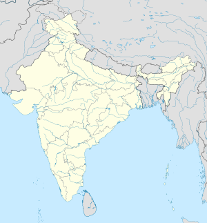
Suba ang Sābli sa Indiya.[1] Nahimutang ni sa estado sa State of Gujarāt, sa kasadpang bahin sa nasod, 1,100 km sa habagatan-kasadpan sa New Delhi ang ulohan sa nasod.
Ang mga gi basihan niini
- ↑ Sābli sa Geonames.org (cc-by); post updated 2012-12-07; database download sa 2016-08-15

