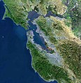
ملف:BayareaUSGS.jpg

حجم هذه المعاينة: 578 × 600 بكسل. الأبعاد الأخرى: 231 × 240 بكسل | 463 × 480 بكسل | 769 × 798 بكسل.
الملف الأصلي (769 × 798 بكسل حجم الملف: 613 كيلوبايت، نوع MIME: image/jpeg)
تاريخ الملف
اضغط على زمن/تاريخ لرؤية الملف كما بدا في هذا الزمن.
| زمن/تاريخ | صورة مصغرة | الأبعاد | مستخدم | تعليق | |
|---|---|---|---|---|---|
| حالي | 00:08، 19 أبريل 2009 |  | 769 × 798 (613 كيلوبايت) | Yarnalgo | rmving little border on top and right and rmving USGS watermark |
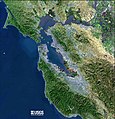
| 15:14، 22 ديسمبر 2006 |  | 770 × 800 (98 كيلوبايت) | Nk | Satellite map of the San Francisco Bay Area from the U.S. Geological Survey. The effect of the San Andreas Fault on the terrain can been seen on a diagonal line from the upper left corner to the lower right. The green and golden mountainous regions (wri |
استخدام الملف
أكثر من 100 صفحة تستخدم هذا الملف. القائمة التالية تعرض فقط أول 100 صفحة تستخدم هذا الملف. قائمة كاملة متوفرة.
- ألامو (كاليفورنيا)
- ألاميدا (كاليفورنيا)
- ألباني (كاليفورنيا)
- أميريكان كانيون (كاليفورنيا)
- أنتيوك
- أواكلي (كاليفورنيا)
- أوريندا (كاليفورنيا)
- أوكلاند (كاليفورنيا)
- إل سيرريتو (كاليفورنيا)
- إميريفيلي (كاليفورنيا)
- إيست بالو ألتو (كاليفورنيا)
- باسيفيكا (كاليفورنيا)
- بالو ألتو (كاليفورنيا)
- باي بوينت (كاليفورنيا)
- برينتوود (كاليفورنيا)
- بليسانت هيل (كاليفورنيا)
- بليسانتون (كاليفورنيا)
- بنيسيا (كاليفورنيا)
- بورلينغامي (كاليفورنيا)
- بيتالوما
- بيتسبورغ (كاليفورنيا)
- بيدمونت (كاليفورنيا)
- بيركيلي (كاليفورنيا)
- بيلمونت (كاليفورنيا)
- بينولي (كاليفورنيا)
- خليج سان فرانسيسكو
- دالي سيتي (كاليفورنيا)
- دانفيل (كاليفورنيا)
- دوبلين (كاليفورنيا)
- ديكسون (كاليفورنيا)
- روهنيرت بارك (كاليفورنيا)
- ريتشموند (كاليفورنيا)
- ريدوود (كاليفورنيا)
- ساراتوغا (كاليفورنيا)
- سان أنسيلمو
- سان بابلو (كاليفورنيا)
- سان برونو (كاليفورنيا)
- سان خوسيه (كاليفورنيا)
- سان رافاييل (كاليفورنيا)
- سان رامون (كاليفورنيا)
- سان فرانسيسكو
- سان كارلوس (كاليفورنيا)
- سان ليندرو (كاليفورنيا)
- سان ماتيو (كاليفورنيا)
- سانتا روسا (كاليفورنيا)
- سانتا كلارا (كاليفورنيا)
- سانيفال (كاليفورنيا)
- ستانفورد (كاليفورنيا)
- سونوما (كاليفورنيا)
- سووث سان فرانسيسكو (كاليفورنيا)
- سويسون سيتي (كاليفورنيا)
- شبه جزيرة سان فرانسيسكو
- شرق الخليج (منطقة خليج سان فرانسيسكو)
- شمال الخليج (منطقة خليج سان فرانسيسكو)
- غيلروي (كاليفورنيا)
- فاكافيل
- فاليجو (كاليفورنيا)
- فريمونت (كاليفورنيا)
- فوستير سيتي (كاليفورنيا)
- فيرفيلد (كاليفورنيا)
- قائمة مدن وبلدات منطقة خليج سان فرانسيسكو
- كامببيل (كاليفورنيا)
- كلايتون (كاليفورنيا)
- كوبيرتينو (كاليفورنيا)
- كونكورد (كاليفورنيا)
- لاركسبور (كاليفورنيا)
- لافاييتي (كاليفورنيا)
- لوس ألتوس (كاليفورنيا)
- لوس غاتوس (كاليفورنيا)
- ليفرمور (كاليفورنيا)
- مارتينز (كاليفورنيا)
- ماونتن فيو (كاليفورنيا)
- مضيق جولدن جيت
- مقاطعة ألاميدا (كاليفورنيا)
- مقاطعة سان ماتيو (كاليفورنيا)
- مقاطعة سانتا كلارا (كاليفورنيا)
- مقاطعة سولانو (كاليفورنيا)
- مقاطعة سونوما (كاليفورنيا)
- مقاطعة كونترا كوستا (كاليفورنيا)
- مقاطعة مارين (كاليفورنيا)
- مقاطعة نابا (كاليفورنيا)
- مل فالي
- منطقة خليج سان فرانسيسكو
- موراغا (كاليفورنيا)
- مورغان هيل
- ميلبراي (كاليفورنيا)
- ميلبيتاس (كاليفورنيا)
- مينلو بارك (كاليفورنيا)
- نابا (كاليفورنيا)
- نهر الروسي (كاليفورنيا)
- نوفاتو (كاليفورنيا)
- نيوارك (كاليفورنيا)
- هالف موون باي (كاليفورنيا)
- هايوارد (كاليفورنيا)
- هيركوليس (كاليفورنيا)
- هيلدسبورغ (كاليفورنيا)
- هيلسبورووغ (كاليفورنيا)
- وادي السيليكون
- والنوت كريك (كاليفورنيا)
- ويندسور (كاليفورنيا)
عرض المزيد من الوصلات إلى هذا الملف.
الاستخدام العالمي للملف
الويكيات الأخرى التالية تستخدم هذا الملف:
- الاستخدام في az.wikipedia.org
- الاستخدام في bg.wikipedia.org
- الاستخدام في bs.wikipedia.org
- الاستخدام في ceb.wikipedia.org
- الاستخدام في cs.wikipedia.org
- الاستخدام في de.wikipedia.org
- الاستخدام في en.wikipedia.org
- Alameda, California
- Talk:Berkeley Software Distribution
- Berkeley, California
- Dumbarton Bridge (California)
- Talk:Dilbert
- Golden Gate Bridge
- Talk:Golden Gate Bridge
- Talk:Emperor Norton
- Talk:John Adams (composer)
- Talk:John Walker Lindh
- Los Altos, California
- Talk:Metallica
- Talk:Mark Twain
- Talk:Monica Lewinsky
- Talk:Napster
- San Francisco Bay
- San Francisco Peninsula
- Talk:Steve Wozniak
- Talk:Shirley Dean
- Talk:San Francisco Peninsula
- Talk:Tom Waits
- Talk:The Residents
- Talk:Temple of Set
- Talk:Ursula K. Le Guin
- Sacramento River
- Talk:The Graduate
- Talk:Philip K. Dick
- Talk:Ken Kesey
- Talk:George Lakoff
- Talk:Mark Bingham
- San Francisco
- Oakland, California
- Talk:AMD
- Fremont, California
- Palo Alto, California
- San Jose, California
- Talk:NeXT
- Talk:Apple Inc.
- Richmond, California
- Albany, California
- Vacaville, California
اعرض المزيد من الاستخدام العام لهذا الملف.
